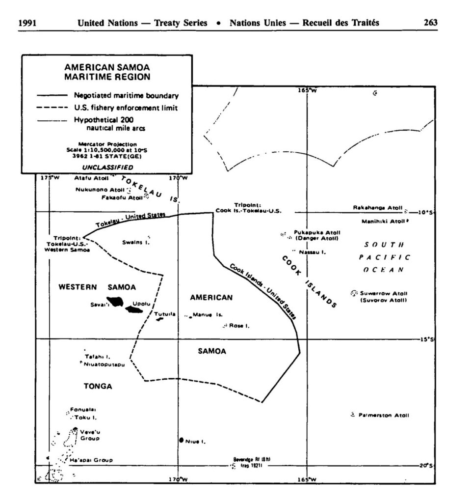
(English & Tokelauan version) Treaty between the US and New Zealand on the delimitation of the maritime boundary between American Samoa and Tokelau, 2 December 1980
- Summary
This legal document contains the English and Tokelauan version of the Treaty between the US and New Zealand on the delimitation of the maritime boundary between American Samoa and Tokelau (New Zealand), signed on 2 December 1980.
Specific coordinates constituting the maritime boundary between American Samoa and Tokelau are listed in Article 1 of the Treaty.
Notably, in the commencement section of the Treaty, it is noted that "the United States of America has maintained a claim to sovereignty over the islands of Atafu, Nukunonu, and Fakaofo and that this claim has not been recognized by New Zealand or the people of Tokelau."
In Article 5 of the Treaty, it is stated that "The United States recognizes that sovereignty over the islands of Atafu, Nukunonu, and Fakaofo, together comprising Tokelau is vested in the people of Tokelau and is exercised on their behalf by the Government of New Zealand pending an act of self-determination in accordance with the Charter of the United Nations.:
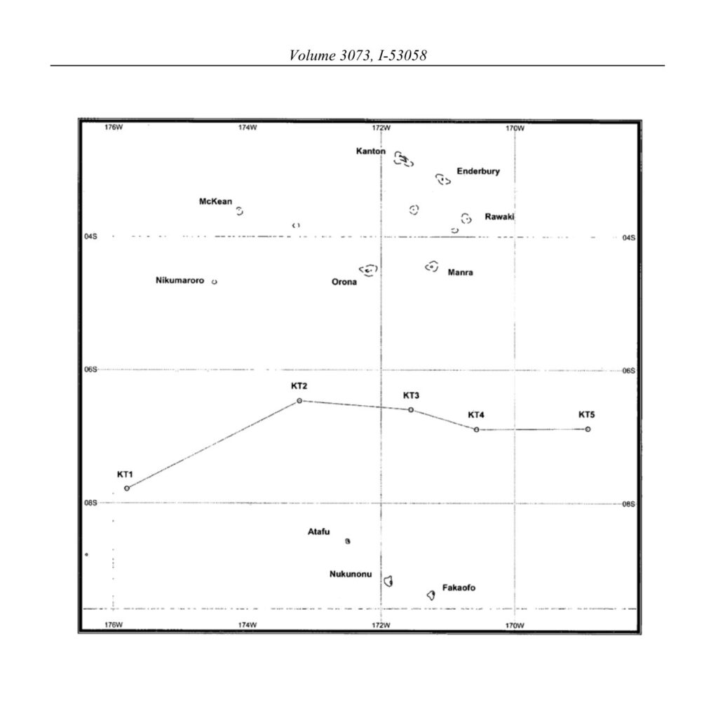
(English & Tokelauan version) Agreement between New Zealand and Kiribati concerning the delimitation of the maritime boundaries between Tokelau and Kiribati, 29 August 2012
- Summary
This legal document contains the English and Tokelauan version of the Agreement between New Zealand and Kiribati concerning the delimitation of the maritime boundaries between Tokelau (New Zealand) and Kiribati, signed on 29 August 2012.
As stated in Article 1, the boundary line is formed using the equidistant method, based on the distance between the nearest territorial sea baseline of the two states. Specific coordinates constituting the boundary line are listed in Article 2.1. Article 3 states how the continental shelf boundary, in case where it extends beyond 200 nm of the EEZ, shall be completed.
(English, French & Tokelauan version) Agreement between France and New Zealand concerning the delimitation of the maritime boundaries between Wallis and Futuna and Tokelau, 30 June 2003
- Summary
This legal document contains the English, French, and Tokelauan version of the Agreement between France and New Zealand concerning the delimitation of the maritime boundaries between the French Republic off the Territory of Wallis & Futuna, and Tokelau (New Zealand), signed on 30 June 2003. Specific coordinates constituting the maritime boundary are listed in Article 2.2 of the Agreement.
- Document: Agreement between France and New Zealand concerning the delimitation of the maritime boundaries between Wallis and Futuna and Tokelau, 30 June 2003 (English, French, and Tokelauan)
(English & Tokelauan version) Agreement between Cook Islands and New Zealand concerning the Delimitation of Maritime Boundaries between the Cook Islands and Tokelau 8 April 2010
- Summary
This legal document contains the English and Tokelauan version of the Agreement between the Cook Islands and New Zealand concerning the Delimitation of Maritime Boundaries between the Cook Islands and Tokelau, signed on 8 April 2010.
Tokelau (Tokelau Islands) is a dependent territory of New Zealand that is constituted by tropical coral atolls.
Article 1 of the Agreement specifies the use of the equidistant method in maritime boundary demarcation.
Article 2 provides the specific coordinates constituting the maritime boundary.
Article 3 clarifies that shall there be a continental shelf boundary between the Cook Islands and Tokelau that locates beyond both's EEZ and thus necessitates the extension of the boundary stated in Article 2, such boundary line shall be extended in accordance with international laws.


